Bombay-South-1954-Topographic-Map
India Maps
 Rivers India map
 India physical map
 Delhi and Agra Operational Navigation Chart
 India
India Map extreme points of India
 India numbered stats
 Calcutta map 1945 City Plan
 India railway schematic map
 India small map
 India geology zones
 Historic maps british India
 Location of Delhi
 Historical map of India in 1760
 India city scale map
 Indien map 2006
 Rivers map of India
 State and union territories India map
 Large city population density India map
 India geological regions map
 India airports and seaports map
 Rivers and lakes topographic map
 Bombay India historical map 1954 City Plan
 India geology map
 Rivers and lakes India map
 India flag map
 Religions map of India 1987
 India historical map 1760 from The Public Schools Historical Atlas
 India stats map
 States and union territories of India
 Crop areas map of india 1973
 Delhi and Vicinity histrotical map 1962 City Plan
 India tourist map
 Historical map India
 india wfb map
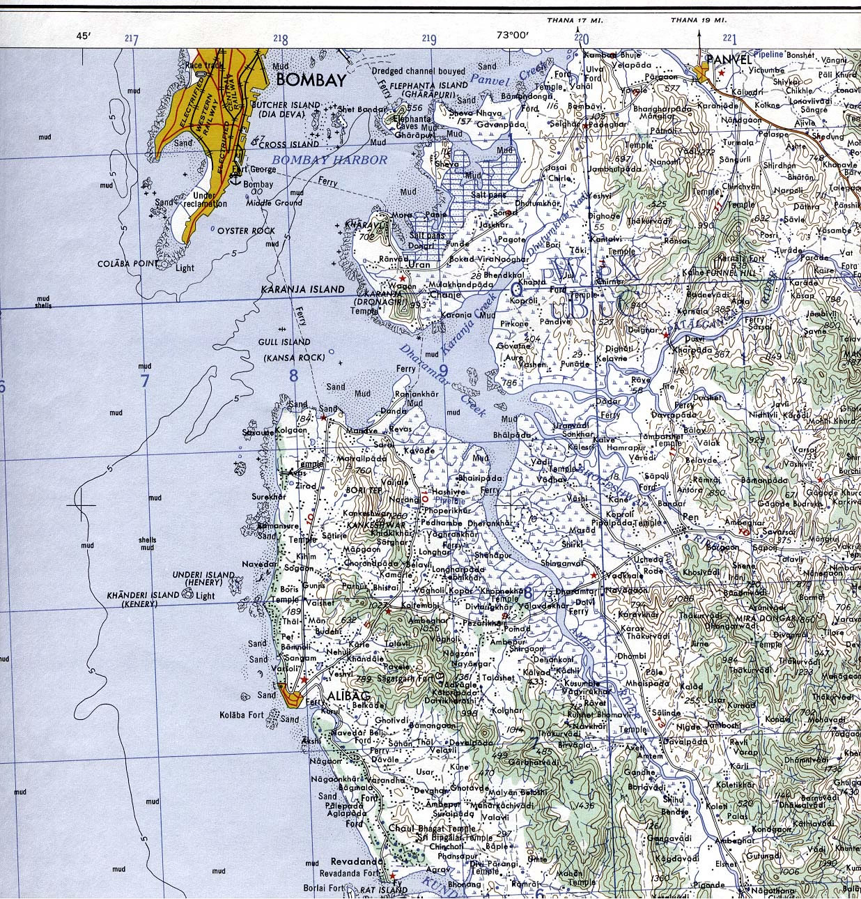
 Bombay South 1954 Topographic Map