Bhuj-Anjar-Area-Gujarat-Topographic-Map-1955
India Maps
 Bombay North 1954 Topographic Map
 Small map of india
 Railway network map
 India national roads map
 Map India
 India rajasthan locator map
 Airports and seaports map
 India climatic zone map
 India map
 Delhi and Vicinity histrotical map 1962 City Plan
 West India map
 India South asia Map
 Rivers map of India
 Physical features of India map
 India historical map 1700 1792 from The Historical Atlas
 India flag map
 India districts map
 India geological regions map
 India historical map
 India geographical map
 South asia local India map
 Topographic India map
 Blank colored India map
 Distribution of christians in Indian states map
 South India regions map
 India stats map
 Damao Daman 1954 Topographic India Map
 Political map of India 2001
 Bombay South 1954 Topographic Map
 India disputed areas map
 South asia India satellite map
 India satellite map
 Bombay India historical map 1909
 Karte indien bundesstaaten unionsterritorien
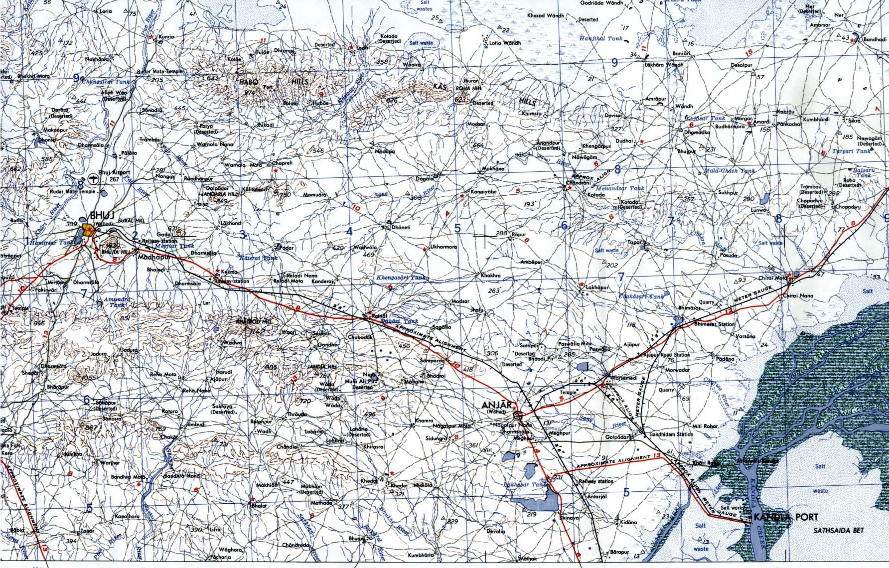
 Bhuj Anjar Area Gujarat Topographic Map 1955