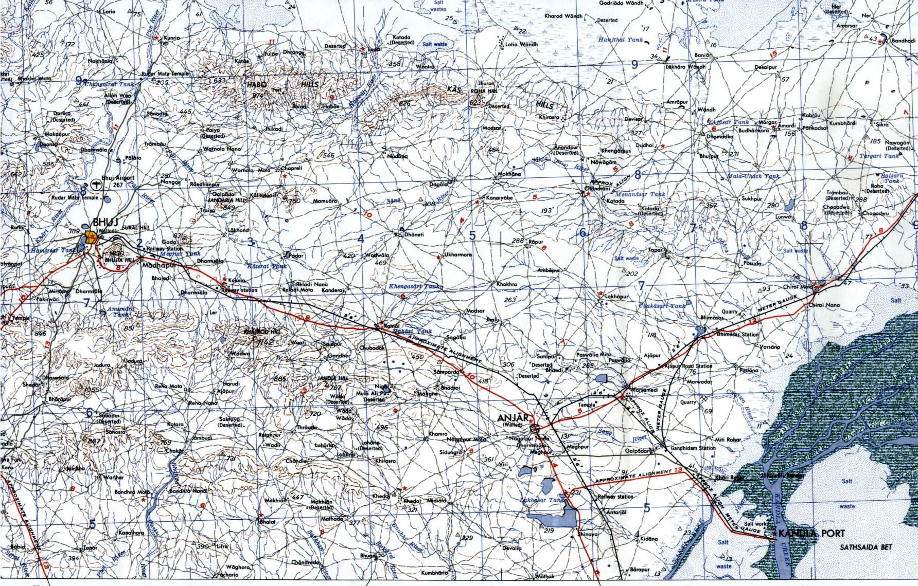
Bhuj-Anjar-Area-Gujarat-Topographic-Map-1955
India Maps
 India geology zones
 Rivers and lakes India map
 South asia local India map
 Map of relief India
 South India regions map
 Indian railways map
 India historical map 1700 1792 from The Historical Atlas
 India Transportation map
 India numbered stats
 India airports and seaports map
 Bombay South 1954 Topographic Map
 Bombay India historical map 1909
 Distribution of christians in Indian states map
 India rajasthan locator map
 Political map of India 2001
 Crop areas map of india 1973
 India citys map
 India geology map
 India physio map 2001
 India location world map
 India city scale map
 Map of India airport city states
 Shared relief map of India 1979
 Relief map of India 1996
 Map India
 Population density India map
 India disputed areas map
 India locator map blank
 Airports and seaports map
 India railway schematic map
 India china border western sector 1980
 Historical map of India in 1760
 India flag map
 India historical map 1882, Commerce and Commercial Navigation
 India topographic blank map